Friday, December 19, 2008

Holiday Hours

Arader Galleries Holiday Schedule:

Wednesday, December 24th– OPEN until 3 p.m.

Thursday, December 25th – CLOSED

Friday, December 26th - CLOSED

Saturday, December 27th through
Tuesday, December 30th – OPEN (regular hours)

Wednesday, December 31st – OPEN until 3 p.m.

Thursday, January 1st – CLOSED

Happy Holidays!

Tuesday, December 16, 2008

John Gould’s The Birds of Australia: A Copy Once Owned by the Governor of Tasmania, Captain John Franklin


John Gould (1804-1881)
The Birds of Australia (and Supplement)
Eight bound volumes including supplement
Folio size: 21 3/8” x 14 3/8”
Printed by Richard and John E. Taylor
Published by the Author, 1840-1848; 1851-1869
681 hand-colored lithograph plates

John Gould’s monumental Birds of Australia magnificently displays the author’s scientific skill and attention to detail and provides a more complete study than his Synopsis of the Birds of Australia and The Birds of Australia, and the Adjacent Islands. At its time of publication the birds of this region were essentially unknown to a European audience and as Gould himself admitted in the
preface to the book, “the field was comparatively a new one”.

In September 1838, the author and his wife, Elizabeth, arrived in Australia and spent the following 18 months exploring Tasmania and the adjacent islands, South Australia, and new South Wales. Upon the discovery that she was pregnant, Elizabeth Gould resolved to remain in Tasmania while her husband set about discovering the birds of Australia’s interior. She was to stay with the Governor of Van Diemen’s land (Tasmania), John Franklin, during this time and became fast friends with the Governor’s wife. Thus, it was that Captain Franklin became a subscriber to the Birds of Australia. An autographed letter, dated April 1877 and written by Henry Elliot, sheds additional light on the provenance of the present edition. He writes: “This copy of Gould’s Birds of Australia belonged to Sir John Franklin to whom I was aide de camp, and in whose house, while Governor of Tasmania, Gould lived many months while making his Collection. I had myself made a collection of the Birds of Tasmania, and gave many of the specimens to Gould. After the death of Sir J. Franklin’s widow in 1876 this copy of the work was given to me by his niece . . .” The letter is inserted into the first volume of the book and indeed, Gould acknowledges the assistance of both Elliot and Franklin in his preface.

The Birds of Australia is John Gould’s largest and most important work. Because he himself spent so much time in the field making his own observations, the text that accompanies the illustrations is by far the most accurate and detailed of all his works. Moreover, it is such a complete study that very few additions have ever been made to the study of Australian ornithology.


We are pleased to announce that this landmark work in ornithology is currently at the San Francisco location and available for viewing upon request. Please call Arader Galleries at 415.788.5115 for price inquiries and to request the catalog.

Friday, December 12, 2008

Engravings from the Landmark Publication on British Georgian Architecture


Colen Campbell (1676–1729)
From Vitruvius Britannicus
London, [1715-1725] 1767
Copperplate engravings

Colen Campbell (1676–1729) was a Scottish-born architect who published the single most influential work of architecture published in the Georgian era (1714-1811). As the title suggests, the work focuses upon the writings of the Roman architectural author, Vitruvius, and testifies to Campbell's outright rejection of the French influence upon British architecture, so prevalent during the reign of the late Stuart monarchs. The book champions the classical purity of line, which pervaded the work of the English court architect, Inigo Jones (1753-1652) and the Italian architect, Andrea Palladio (1508-1580), both considered exemplars of the style by Campbell.

Additionally, the book represents the rise of the nobility and professional designer as arbiters of fashion, a facet of British culture previously dominated by royalty. The British countryside, as we know it today, was the creation of the Georgian period. The nobility now enjoyed new found wealth largely due to the Seven Years’ War, when the Crown had given land to loyal supporters. This land was mainly concentrated into large estates, and its owners either sat in the House of Commons or knew people who did. Thus, the land enclosure acts, which allowed for the most modern methods of farming, were easily passed and as a result agriculture became a profitable enterprise. For the first time the elite could afford to build grand homes for themselves and to receive members of the royal family. While ‘Capability’ Brown supplied the design for magnificently landscaped gardens, Campbell’s Vitruvius Britannicus provided a marvelous template for the design of the house.

To view Arader Galleries' selection of Campbell architectural engravings currently available for purchase, visit www.aradersf.com, call 415.788.5115 to request a Campbell catalog, or visit our San Francisco gallery location.

Wednesday, December 10, 2008

Gifting Art

Jacques Barraband (1767-1809)
La Perrruch Lori Pl. 52
From Histoire Naturelle des Perroquets
Paris: 1801-5
Hand-colored copperplate engravings


Pierre Joseph Redoute (1759-1840)
From Choix des Plus Belles Fleurs
Paris: 1827-1833
Hand-colored stipple engravings
12 3/4” x 9 1/2”


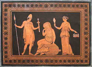
William Hamilton
From Collection of Etruscan, Greek and Roman Antiquities from the Cabinet of the Honorable William Hamilton…
Naples: 1766-1767
Aquatint engraving in black and terra-cotta ink
25” x 35” framed

As Christmas nears, the dilemma of gift giving becomes more and more evident. Everyone is sure to have one or two difficult people, where coming up with an inspiring gift for him or her seems impossible. Art can be a memorable gift that provides enjoyment for a lifetime. Indeed, art is similar to a perpetuity—the reward potential has no definite end. Furthermore, gifting art can be more than a vehicle for providing someone with a memorable gift, but also an exciting and rewarding process for the benefactor.

In this financial climate, where we are all spending a little more carefully, the pursuit of appropriate gift giving requires additional consideration.* In this spirit, Arader Galleries humbly offers some guidance on the purchase of art and artful things for every budget. First, we are fortunate to live in San Francisco a city with such fine culture, arts foundations, and retail galleries staffed with knowledgeable scholars and gallery owners. When you consider purchasing art, be comforted by the assurance you are selecting from some of the best collections and from the most knowledgeable professionals in the world. Second, art dealers do not expect that just because you came into their store that you are going to buy.

Some questions to ask, particularly if you want to purchase an item as a gift, concern the gallery’s return/exchange policy. For example, if you purchase the work as a gift it is prudent to ask whether the recipient has the option of going back to the gallery and selecting something else if they do not find it suited exactly to his or her taste. Like most galleries and antique dealers in the Jackson Square district of San Francisco, Arader Galleries allow gift recipients to exchange items.

Also, reputable dealers will produce documentation for authenticity and insurance purposes. We, like many gallery owners, offer assurance on the authenticity of everything in our inventory. If it is your first time purchasing from a gallery, do not hesitate to inquire about their authenticity standards and policy.

Gift certificates are a fine option as well. For example, suppose you found a gallery you want to purchase from but are having trouble selecting a piece. Talk to one of the dealers about allocating a sum of money for a certificate, enabling the recipient to select their ideal work of art.

Art galleries can provide valuable installation advice for light sources, hanging fixtures, and climate controls. Arader Galleries provides these services free of charge. Also, we have a terrific collection of reference books to enrich your understanding and appreciation of newly acquired pieces. Indeed, the mark of a collector involves keeping careful documentation on the work, such as place of purchase, value, and respective historical importance.

So with these guidelines in mind, Jackson Square is the premier Bay Area destination for gifting art. If you are interested in antique prints please stop by Arader Galleries. We have the world's largest selection of the works of John James Audubon, Pierre-Joseph Redoute, Giovanni Battista Piranesi, historically important maps, natural history engravings and watercolors, lithographs of the American West, Californiana, Hawaiiana and Western Americana.

The significance of gifting art lies in its ability to generate a communal appreciation for beauty. A true collector buys art for a purpose that stems beyond a show and tell, conversation piece. Rather, a true collector purchases art to share their passion for art with others and what better way to do so than by gifting art. We wish you an entertaining and exquisite holiday season!

*Lucinda Edinberg, “Art for the Holidays,” The Capital 8 Dec. 2008: 1.

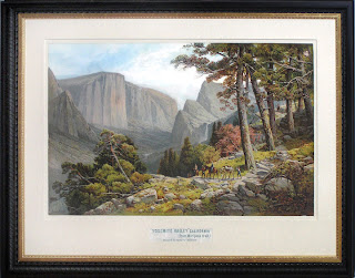
Yosemite Valley by Andrew Melrose

Andrew W. Melrose (1836-1901)
“Yosemite Valley” California (from Mariposa Trail)
Washington, DC: 1887
Chromolithograph
35 ½” x 47” framed

The son of the artist George Melrose, Andrew Melrose was born in Selkirk, Scotland in 1836. He later moved to the United States, keeping a studio in New Jersey until his death in 1901. A painter of landscapes, Melrose traveled the United States and Ireland in search of majestic natural beauty. His best-known works are of the landscapes of Yosemite.

This iconic view of Yosemite Valley, from the vantage point of Sentinel Dome with El Capitan, Cathedral Rock, the Merced River and the Bridal Veil Falls in the distance, is a chromolithograph created from a painting by Melrose. After the completion of the transcontinental railroad in 1869, many more tourists where able to visit the Yosemite Valley. Chromolithographs, often sold for a few cents a piece, were an affordable souvenir.


Works by Melrose are included in the collections of the New York and New Jersey Historical Societies, the Newark Museum and Oberlin College.


This iconic view of Yosemite, along with other California landscapes by noted artists such as Albert Bierstadt, Thomas Hill and William Keith, is currently on display at Arader Galleries San Francisco location. For more information visit www.aradersf.com or call us at 415-788-5115.

Friday, December 5, 2008

W. Graham Arader on the Economics of Maps

W. Graham Arader III was recently interviewed by Bloomberg radio for their ‘On the Economy’ series. Mr. Arader gives his expertise, from 35 years in the rare map business, on map collecting and current market for antique maps. We think you will find this a very interesting interview!

Click here for the interview

Monday, November 17, 2008

Empress Eugenie to the Prince of Chintz: a Short History of Furnishing with Antiques

Empress Eugénie (1853-1871)

Two members of the Arader Galleries team attended the American Decorative Arts Forum lecture on Tuesday, November 11, 2008. The topic was “Empress Eugenie to the Prince of Chintz: a Short History of Furnishing with Antiques.” Jared Goss, Metropolitan Museum of Art, New York, spoke with enthusiasm and, might I add, velocity on the interesting history of antique decorating. In today’s designer conscience world it is hard to believe that before the 19th century there was no such thing as decorating with antiques. The Renaissance marks the transition to a new type of collecting as people no longer sought out art and artifacts solely for their devotional purposes but for their intellectual, historical, scientific, nostalgic, or commercial significance, yet not for their aesthetic value.* Indeed, prior to the 19th Century people did collect old objects but generally only as a means of demonstrating their intellect.

Mr. Goss began his presentation by tracing the influence of the English Country Home on antique furnishing. The romance of the English Country House décor evolved from the incorporation of fashions from previous generations with current ones, which explains why it has such deep roots in the history of antique decorating. The idea of mixing the “old with the new” first manifested itself here. In 1897 Country Life Magazine was published which showed off Britain’s country homes and contributed to the advancement of country home décor. Nancy Lancaster (1898-1994) perfected and popularized English Country Home decorating with her signature swaggered curtains, large fire places, and upholstered couches.

The Industrial Revolution contributed to the phenomenon of antique decorating for several reasons. Firstly, the emergence of the nouveau riche from the cities, combined with advances in transportation systems (creation of railroads), made countryside homes less remote and therefore the décor more assessable and popular than ever. Secondly, industrialization drastically drove down the cost of furniture, allowing people of modest income the ability to afford new furniture for the first time. The rich, always wanting things that others couldn’t afford, looked to antiques as a means of maintaining their visual social hierarchy.

Accredited for incorporating her nostalgia for aristocratic France into décor, Empress Eugénie (1853-1871) is a classic example of someone using the “cult of the past” to assert her legitimacy. Married to Napoleon the III, the last empress of the France aligned herself with Empress Josephine and, above all, Marie Antoinette because like Marie Antoinette she was foreign at court—herself a Spaniard in the French Court as Marie was an Austrian in the French Court—in order to emphasize her stateliness. Famous for her restoration projects, Empress Eugénie refurbished the Petite Trion and Malmaison, among others, with period pieces. Her desire to align herself with the past was so great she even painted rooms blue due to the fact it was Marie Antoinette’s favorite color.

By the end of the 19th Century, the first design schools were founded during this time, including the Road Island School of Design and Parsons in 1877 and 1896, respectively. Education was crucial in differentiating between amateurs and legitimate designers. Furthermore, the first books on interior design were published in by the end of the 19th, early 20th century as well: “The Decoration of Houses” by Edith Wharton and Oyden Codman Jr (1897) and “The House in Good Taste” by Elsie du Wolfe (1914), which are still in publication today. The concept of interior decorating is a 20th century concept and Du Wolf has earned the accreditation as the first official decorator.

The Great Depression of the 1930’s caused many Americans to move to smaller living quarters as they could no longer afford servants. This event caused interior design to take a turn towards functionality. It follows then that contemporary interior design, Mario Buatta or the “Prince of Chintz” designs rooms that are full of chintz, color, classicism and, most importantly, comfort. Mr. Buatta incorporates elements from English Country Home décor with comfort and functionality, bringing the evolution of antique furnishings full circle.

All in all, Mr. Goss educated and captivated us from beginning to end. I hope our summation leaves you enlightened on the history of antique furnishings. The last lecture of the ADAF 2008 season will take place on December 9 at 8pm at the de Young Museum on “Pets in America: Their History through Portraits and Possessions.” Hope to see you there!

* Miles Harvey, “The Island of Lost Maps,” (New York: Random House, 2000) 70.

Friday, October 31, 2008

Annual Historic Jackson Square Holiday Walk


We invite you to join all of us in Jackson Square to welcome in the holiday season with our annual holiday walk. Enjoy a leisurely evening strolling through historic Jackson Square exploring the fascinating world of art, antiques and design amidst the glow of our holiday lights and good cheer!

Thursday, December 4th
5 p.m. - 8 p.m.
Historic Jackson Square, San Francisco
Shops are located on Jackson Street between Columbus and Sansome, Gold Street, and Sansome Street between Jackson and Battery.
This event is invitation only.
For more information, please visit the
San Francisco Jackson Square web site.

Tuesday, October 21, 2008

Gerard Mercator: The Most Celebrated Sixteenth-Century Cartographer


Gerard Mercator (1512-1594) / Jodocus Hondius (1563-1612)
“Orbis Terrae Compiosa Descriptio”
From Atlas
Amsterdam: c. 1623-1630
Hand-colored copperplate engraving

For nearly sixty years, during the most important and exciting period in the story of modern mapmaking, Gerard Mercator was the supreme cartographer, his name, second only to Ptolemy, synonymous with forms of map projection still in use today. His influence transformed land surveying and his research and calculations lead him to break away from Ptolemy’s conception of the size and outline of the continents, developing a projection that drastically reduced the longitudinal length of Europe and Asia and altered the shape of the Old World as visualized in the early 16th century. Although not the inventor of this type of projection, Mercator was the first to apply it to navigational charts in such a form that compass bearing could be plotted on charts in straight lines, thereby providing seamen with a solution to an age-old problem of navigation at sea. Mercator’s innovations, including the aptly named Mercator projection, continue to be employed in maps produced today, 400 years later.

The geographer died in 1594 after publishing just a few parts of the atlas that he had spent decades preparing. In 1604, after the death of Gerard’s son Rumold, the plates for his maps were sold to the great Amsterdam cartographer, Jodocus Hondius, who brought out the first of the so-called “Mercator-Hondius” editions in 1606. Hondius supplemented the original 107 maps with 39 new maps compiled under his own supervision, bringing the total number to 146, and had the original text expanded by Petrus Montanus. The new maps were of extremely high quality, and were for the most part devoted to parts of the world, such as America, that had been neglected by Mercator. Hondius’s first edition of the general atlas proved instantly popular, selling out within a year. Hondius continued to augment and perfect the atlas over the following years, constantly adding new maps and incorporating new discoveries and corrections. The first French edition came out in 1607, with a translation of the text by the historian Henri Lancelot-Voisin de la Popliniere. This world map is thought to have been published in the 1620s, as the title on the top edge shows the cracks that had developed in the copperplate in this time frame (Shirley, Mapping of the World).

Unlike the work of Abraham Ortelius, a contemporary (and equally celebrated) cartographer, Mercator’s maps were original. Ortelius engaged in the reduction and generalization of already existing maps, while Mercator, with his sense that scientific work should be original and new, checked the current knowledge of the earth’s topography against its fundamental sources and drew maps in an original manner. Mercator was the most skilled mapmaker of his time, spearheading the Golden Age of Dutch cartography. His maps were unsurpassed in terms of accuracy, and no less attention was given to their beauty. Other cartographers looked inevitably to the innovations of Mercator when compiling their own maps, and the reasons for such tribute are clear in every map contained in this spectacular atlas. Vividly hand-colored, it brought distant and exotic places to European viewers with outstanding clarity and immediacy, describing not just the terrain, but also including images of flora and fauna, as well as native peoples. Fearsome sea monsters and European sailing ships adorn the seas, while the glorious Baroque cartouches add gracefully curving architectural elements to the images. This beautifully-colored double hemisphere map of the world represents a great opportunity to acquire the most spectacular map from this landmark publication by the foremost cartographer in history.

This splendid world map is currently on display along with a selection of other fantastic maps of the world and the Americas by Abraham Ortelius, Alexis-Hubert Jaillot, Guillaume de L’Isle and Mercator's grandson, Michael Mercator. For more information please visit www.aradersf.com or call Arader Galleries at 415-788-5115.

Saturday, October 18, 2008

The San Francisco Fall Antiques Show

Plate 26 - Carolina Parrot from John James Audubon's Birds of America

Arader Galleries is thrilled to announce that we will be participating in the San Francisco Fall Antiques show this year! We invite you to stop by to see our extraordinary collection of antique prints, original paintings, globes and furniture. Our collection at the show will include new inventory that has not been on display at our San Francisco locations.

The San Francisco Fall Antiques Show
Preview Party Benefit Gala
Wednesday, October 28, 2009, 7 to 9 p.m.
Show Dates/Times
October 29 to November 1, 2009
Thursday - Saturday, 11 a.m. to 7 p.m.
Sunday, Noon to 6 p.m.
Location
Festival Pavilion, Fort Mason Center, San Francisco, CA
For more information about the San Francisco Fall Antiques show, please visit www.sffas.org.

Wednesday, October 8, 2008

John Gould Artist Proofs


John Gould (1804-1881)
Artist proofs for The Birds of Europe
"Spoonbill" (top image)
"Marsh Sandpiper" (center image)
“Wood Sandpiper, Green Sandpiper” (bottom image)
London: 1832-37

Lithographs with hand-written notations


John Gould was without question the most prolific natural history artist of the 19th century, and the only one to rival John James Audubon in ambition and quality. The 19th century was a time of intense fascination with discoveries in natural history, especially regarding knowledge of the wildlife of exotic lands. Gould shared the romantic enthusiasm of his time for such subjects, as well as the popular impulse to catalogue exotic wildlife. He combined his passion for natural history with outstanding scientific, artistic, and entrepreneurial talents. Drawing on these abilities, he embarked on a series of projects that would eventually make him the leading publisher of ornithological illustrations in Victorian Britain. Gould’s unparalleled career spanned five decades, and he produced a monumental series of books of birds throughout the world.

From the time he took up taxidermy in his early teens, Gould was devoted to recording bird life, either as he observed it personally or as it was reported to him by other ornithologists. He procured the scientific information through extensive correspondence, travel, and field research. The preparatory drawings that he produced were passed on for completion to skilled illustrators, most notably his wife, Elizabeth, and Edward Lear. The plates which resulted from such partnerships were a splendid fusion of art and science, with a scope than remains
unsurpassed. Stunning and at the same time highly accurate, Gould’s illustrations linked beauty to science, and science to beauty, in and an unprecedented manner.

One of the most accomplished and engaging natural history works of the 19th century, The Birds of Europe was also the first of Gould’s works to feature plates by Edward Lear. A total of sixty-eight images bear Lear’s name, and they are among the most remarkable bird drawings ever made. Lear endowed his illustrations with some measure of his own whimsy and intelligence, and his style is at once fluidly spontaneous and realistically precise. In this way, the images of The Birds of Europe are amazingly distinctive, while also highly realistic.

Gould undertook this work partly in an effort to redress the imbalance between the study of local and foreign ornithology. In his preface he stated his mission: “the Birds of Europe, in which we are, or ought to be, most
interested, have not received that degree of attention which they naturally demand. The present work has been undertaken to supply that deficiency.” Gould portrayed birds native to Europe in a manner that had only been thought appropriate for the colorful species of distant places. In this way he managed to draw much popular interest back to native birds, which were suddenly considered equally beautiful to exotic species. These proofs, which have notations by the Goulds, were part of the the final preparation stages for this publication.

These artist proofs (show above and at www.aradersf.com) are currently available for purchase at Arader Galleries. For more information, please call 415.788.5115.

Wednesday, September 24, 2008

"Pacific Coast Scenes" by Jorgensen


Christian A. Jorgensen (1860-1935)
“Pacific Coast Scenes”
Supplement to the Christmas edition of The Wasp
San Francisco: 1884, Bosqui Eng. & Print Co.
Lithograph
35” x 43” framed

Born in Oslo, Norway, Jorgensen moved to San Francisco with his mother in 1870. He showed artist promise at an early age, and was among the first students to enroll in the School of Design when it opened in 1874. While at art school Jorgensen was greatly influenced by his instructor and artist Virgil Williams, whom was both a mentor and father figure to Jorgensen. Jorgensen later became an instructor at the School of Design and served as assistant director from 1881-1883. He then established a studio at 131 Post Street in San Francisco, and by the mid 1880s had a successful career as a landscape painter. He was also a member of the Bohemian Club from 1899-1904.


For five years, Jorgensen and his wife traveled by horse and buggy to the sites of the 21 California missions, producing watercolor studies of the missions and a complete set of oils. A lithograph collage of these views, “Pacific Coast Scenes,” was published as a supplement to The Wasp in 1884. Included were views of San Francisco, Monterey, Santa Barbara, Lake Merritt (Oakland), Lake Lagunitas, Guerneville, Lakeport and the Hetch Hetchy Valley. The Wasp was a late 19th century weekly satire newspaper founded by Francis Korbel. It was unique for its production of color lithograph prints, a process Korbel had mastered in his previous business of manufacturing cigar box labels.

In 1899, Jorgensen pitched a tent in Yosemite and after several months obtained a permit to build a studio home there. He would continue painting there for the next 19 years during the warmer months (his Yosemite home is now the headquarters for the Government Rangers). In 1905 he built a boulder home in Carmel (now the site of the Hotel La Playa) where he and his wife Angela lived for a few years, though most of his time was spent at his family home in Piedmont. Jorgensen enjoyed a long career and continued painting until his death in 1935. Jorgensen’s work is held in the collections of the Yosemite Museum and the Bohemian Club.

For more information, please contact Arader Galleries at 415.788.5115.

Art International Pasadena Show: Postponed

The Art International Pasadena / Los Angeles show scheduled for October 31sr - November 2nd, 2008 has been postponed until March 12th -15th, 2009.

Tuesday, September 9, 2008

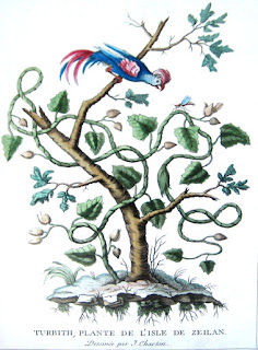
Rococo engravings by Jacques Charton


In the early 18th century, France turned away from imperial aspirations to focus on more personal and pleasurable pursuits. As political life and private morals relaxed, the change was mirrored by a new style in art, one that was more intimate, and decorative.

Louis XIV's desire to glorify his dignity and the magnificence of France had been well served by the monumental and formal qualities of most seventeenth-century French art. But members of the succeeding court began to decorate their elegant homes in a lighter, more delicate manner. This new style has been known since the last century as "rococo," from the French word, rocaille, for rock and shell garden ornamentation. First emerging in the decorative arts, the rococo emphasized pastel colors, sinuous curves, and patterns based on flowers, vines, and shells. Painters turned to the sensual surface delights of color and light, and from weighty religious and historical subjects to more intimate scenes.

These original hand-colored engravings from a collection of fifty-nine from Jacques Charton’s, Collection de plantes etrangeres en fleurs, fruits, corail et coquillages are splendid examples of the French decorative arts produced in Paris in 1784, just previous to the French Revolution. These lovely engravings, most likely executed for porcelain designs, show a variety of exotic natural history subjects, mainly flowering plants and shells, accompanied by animals or insects, some with accompanying background vignettes. The style of representation ranges from the mildly stylized but naturalistic to the intensely fantastical, verging on the surreal such as, a selection of "fruits of the sea" hanging from the branches of a plant emerging from a seashell. This style would soon give way to one that adhered to the austerity and democratic spirit of the revolutionaries at the end of the century.

A full catalog of images from this exceedingly rare and aesthetically beautiful suite of engravings is available at your request.

Friday, August 29, 2008

Rare Book School at the University of London

View of the interior of the print and works on paper archive room at the British Museum's library.

Sixteenth century woodworking tools used by Albrecht Durer in his printmaking studio and shop for his original woodcuts. These are housed in the British Museum's print room.

Laying down paper to pull a print from an inked copperplate. Print workshop director, Michael Mann, from the Slade School of Fine Art in London leads us through the process.

It was an exciting summer for us! Our gallery spent a week in London attending Rare Book School at the University of London. This summer’s course focused on the History of Maps and Mapping which included seminars by top scholars in the field: Peter Barber, Head of British Library Map Collections; Catherine Delano-Smith, Editor of Imago Mundi – The International Journal for the History of Cartography; Laurence Worms, Ash Rare Books; Roger JP Kain, Professor of Geography at University of Exeter; and Sarah Tyacke, President of Imago Mundi and map specialist for Royal Holloway University of London.

During the week, we were able to view select items from the amazing map collection at the British Library. One of the highlights from this collection included an original Martellus manuscript atlas which arrived in England from Italy around 1800 when purchased by George III's son, the Duke of Sussex and then later purchased by the British Museum following the Duke's death in 1844 - truly one of their prized acquisitions.

Another highlight is what Peter Barber claims is one of the most important purchases the British Library has made in recent years - the Mercator Atlas of Europe. A composite atlas containing the only known manuscript maps in Mercator's own hand. Some of the printed maps have annotations in ink in Mercator's handwriting!

To top off this experience, we were also allowed access to the British Museum’s print room. Here, we were able to see some of the items from the permanent collection, including the woodworking tools used by Albrecht Durer to make his woodblocks.

The entire week was an incredible and educational experience! We look forward to next year’s seminars. To learn more about the program we attended, please feel free to contact the School of Advanced Study at the University of London.

Tuesday, August 26, 2008

Arader Galleries Fall 2008 Schedule

We invite you to stop by to see our extraordinary collection of antique prints and original paintings at one of our upcoming shows and gallery exhibitions:

Santa Monica Antiques Show
Friday, September 12 – Sunday, September 14, 2008
http://www.bustamante-shows.com

California: Historically Important Maps, Paintings and Views
Exhibition on display from October – December 2008

John Abbot Syndication of Original Ornithological Watercolors
Saturday, October 11, 2008
Arader Galleries New York City Location

Art International Pasadena / Los Angles
Friday, October 31 – Sunday, November 2, 2008
Gala Preview Thursday, October 30, 2008
http://www.artinternationalfair.com/

Under the Sea: Fish, Coral, Shells and Other Wonders of the Sea
Exhibition on display November – December 2008

Jackson Square Holiday Walk Event
December – Date to be announced

For more information please call 415.788.5115 or visit www.aradersf.com. Hope to see you at one our events this fall!

Monday, August 25, 2008

Gallery support and donation to Salvation Army’s Tools for School program

Arader Gallery employees and friend at Tools for School fundraiser:
Nicole Lopez (from left), Jeannie Berkinshaw and Katherine Casey

On August 6th, 2008 at the Omni hotel in San Francisco, Arader Galleries attended a fundraiser held by The Salvation Army, one of the world’s oldest and largest charities. Tools for School, a fundraiser for underprivileged San Francisco school children annually provides about 2,000 students with basic school supplies. The auction collects money for the program to give classroom essentials and proper clothing to students so they begin the school year concentrating on learning.

Arader Galleries donated a print of two French town views by Mathias Merian of for the auction. Please find more information about the Salvation Army and the Tools for School program at http://www1.usw.salvationarmy.org/usw/www_usw_gstate.nsf

Monday, August 11, 2008

Antique Maps: Who’s the Author?

John Melish
Engraved by J.J. Vallance & H.S. Tanner

Published by John Melish Philadelphia

During the 16th through 19th centuries map-making involved many diverse tasks, and most often the tasks were completed by several different laborers. Map-makers of this time such as Abraham Ortelius, Nicolas Visscher and John Melish did not create their maps and atlases solely by themselves, but as their names are usually the most prominent on the maps, they can appear as the exclusive producer of the map. Maps were conceptualized by the map-maker, Ortelius, Visscher and Melish, and constructed by the surveyor, the draftsman, the engraver, the colorist, and the publisher. At times the cartographer would take responsibility for all tasks in producing a map, but not usually; the cartographer employed a hydrographer to survey and measure the land, a draftsman to draw up a manuscript map by hand, an engraver to create the copperplate and printing, a colorist to paint the printed maps, and a publisher to issue and distribute the maps and atlases.

Generally, the cartographer was the mind behind the creation of the maps and atlases and oversaw his productions. He was someone who often came from a family of map-makers or publishers, seemingly falling into the business but undoubtedly having a great passion for his trade. Others realized the demand for geographical information and sought a profession in map-making.
Abraham Ortelius, for example, started his career as a map engraver. It was through this profession that he became interested in compiling atlases, and so began his career as a map-maker. Later he would go on to become the geographer to Kind Philip II of Spain. In this task he would travel with the King on his expeditions where he would survey land and use his geographical knowledge to navigate and educate the King on his territories and those of other states.

On the other side of the spectrum, Scotsman John Melish began his career as a publisher. After visiting the United States on business and traveling through the territory extensively, he used his travel accounts to produce maps of early 18th century America. Because he was wealthy, Melish was able to employ the very best engravers for his projects and distribute his maps under his own name. After the publishing of his first set of maps and travel accounts, Melish made his business in Philadelphia in commercial cartography and geography.

Ultimately, the map-maker is known as the author, and his name is the name we remember. But there were many tasks necessary in creating atlases full of beautifully printed, colored and, at the time, accurate maps, and for each of these tasks there were specialists waiting to play their parts in making a map.

Thursday, July 31, 2008

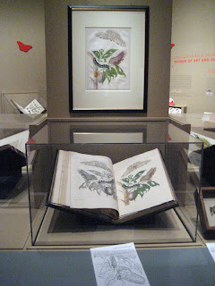
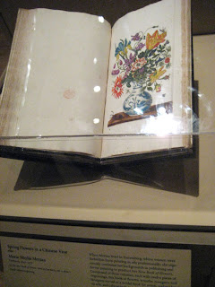
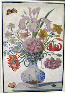
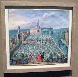
Maria Sibylla Merian and Daughters – Women of Art and Science

We highly recommend a visit the The Getty in Los Angeles to see the wonderful exhibit of works by Maria Sibylla Merian and her daughters.

A large exhibition of many incredible, original watercolors and bound books is on display through the end of August. Many pieces are on loan from the Natural History Museum in London, the Bibliotheque Nationale de France in Paris, Stadel Museum in Frankfurt and others that combine into some of the best examples of Merian’s work we have ever seen! One of the highlights is the original watercolor for Spring Flowers in a Chinese Vase from Merian’s New Book of Flowers (shown below). The intricate detail and imaginative composition are hallmarks of Merian’s style of painting. This particular book served as a model book for artists, embroiderers on silk and cabinetmakers of the time. This was why Merian chose not to overlap any of the flowers in this publication so the whole flower could be used and studied.


For more information on botanical watercolors, watercolor transfers and hand-colored engravings by Merian in the Arader Galleries collection, please visit www.aradersf.com or call 415-788-5115.

Thursday, July 24, 2008

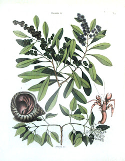
One of the earliest publications on the flora and fauna of North America

Kingfisher by Catesby
Hermit Crab by Catesby

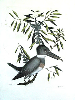
Arader Galleries is pleased to offer a selection of first edition, hand-colored copperplate engravings from Mark Catesby’s The Natural History of Carolina , Florida and the Bahama Islands . The first edition was printed between 1731 -1743 in London , and contains 220 plates published in two volumes, which depict birds, reptiles, fish, insects and mammals. The first volume was printed in 1731, and the second was printed in 1743. It is the first natural history book to use folio-sized color plates, and the first pictorial account of the f
lora and fauna of North America.

In 1712 the English born artist and naturalist embarked on a series of explorations to the southern colonies of British North America. Enthralled by the wildlife, he spent years traveling by foot through parts of present day Virginia, Georgia, the Carolinas and Bahamas. He encountered and documented uncountable varieties of animal and plant life that where entirely unknown to Europeans. These travels would become the basis for Catesby’s breathtaking book.

The Natural History of Carolina, Florida and the Bahama Island
is one of the most sweeping, complete and unique natural history study ever created. It is considered a crowning achievement of 18th century art and science. This work was completed at the same time Linnaeus was working on his Systema Naturae, and used Catesby’s work as the basis of his system of binomial nomenclature for American species.
When Catesby returned to England in 1726 he was unable to afford the expense of having his drawings engraved professionally so he taught himself. He also carefully monitored the coloring either painting the impressions himself, or closely supervising the colorist to insure its fidelity to the original studies.The book provided an important model for later artists including Audubon and Alexander Wilson, who followed in Catesby’s footsteps a century later. His pioneering attempts to describe and portray birds accurately, life-sized and in botanical settings set him apart from his contemporaries.

The first edition of Mark Catesby’s book was printed on imperial folio sized hand-laid papers (approximately 14-1/2 x 20-1/2 inches) with various plate mark dimensions (approximately 9-5/8 x 13-3/8 to at least 10-1/4 x 13-7/8 inches). Chain lines on the paper appear to be uniformly spaced at 1 inch. Two Watermarks identify the first edition of Catesby prints from later editions. The first is the “Strausburg Lilly” over the initials “LVG”, representing the Dutchman Lubertus van Gerre-vink. This is also the same paper in which many of his original drawings are mounted on. A second Watermark found in the first edition is the “IHS” over “I. VILLEDARY”, representing the Jesuits and the Jean Villedary.

Be sure to view our collection of Catesby and other natural history artists such as Audubon, Barraband and Gould at our San Francisco Jackson Square location at 435 Jackson St., or online at www.aradersf.com.

Thursday, July 17, 2008

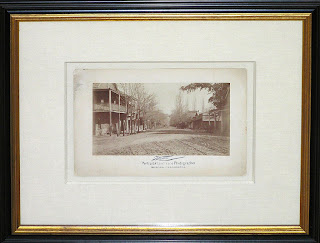
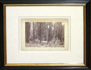
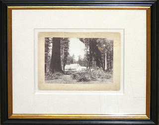
Early photographs of California

Thomas Wells "Sonora, California"

"Giant Sequoias at Calaveras Big Trees Grove"

"Calaveras Big Tree Grove Hotel"

The albumen print, also called albumen silver print, was invented in 1850 by Louis Désiré Blanquart-Evrard, and was the first commercially exploitable method of producing a photographic print on a paper base from a negative. It used the albumen found in egg whites to bind the photographic chemicals to the paper and became the dominant form of photographic positives from 1855 to the turn of the century, with a peak in 1860-90. This new medium was quickly adopted to show the natural beauty of places such as Yosemite National Park, and rapidly growing urban areas, such as San Francisco.

And, many advances to photography in the United States occurred in Northern California. In 1897, Arthur G. Pillsbury, a student at Stanford University, invented the circuit panorama camera. He used this revolutionary camera to record the gold rush in the Yukon and the San Francisco earthquake and resulting fire of 1906. He would later invent the first time-lapse camera in 1912 to demonstrate the growth of plants.
One of the most important moments of photographic history also happened in the San Francisco bay area. In 1872, Leland Stanford, a businessman, race-horse owner and former California governor, had taken a position on a popularly-debated question of the day: whether all four of a horse's hooves left the ground at the same time during a gallop. Stanford sided with this assertion that they did, called “unsupported transit,” and decided to find scientific proof to back his theory. Stanford hired the San Francisco photograph Eadweard Muybridge to settle the issue. To prove Stanford’s claim, Muybridge worked with John D. Isaacs, the chief engineer for the Southern Pacific Railroad, to develop a scheme for instantaneous motion picture capture. In 1878, Muybridge successfully photographed a horse in fast motion to prove Stanford’s claim using a series of 24 cameras. This series of photographs, taken at what is now Stanford University, is called “The Horse in Motion,” and is one of the most popular images in history.


These late 19th century photographs are currently on display at Arader Galleries location in Jackson Square, San Francisco (435 Jackson St.). You can find out more about the gallery at www.aradersf.com or by calling 415-788-5115.

Wednesday, July 2, 2008

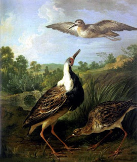
Charming 18th Century Painting of Birds


Christopher Huet (French, 1694-1759)
"Ruffs in a Landscape"
Oil on canvas
Canvas size: 20 1/2” x 17 3/8”
Literature: Christine E. Jackson, Bird Painting - The Eighteenth Century (Woodbridge, Suffolk, 1994), p. 76

Christopher Huet’s informal and intimate painting places male and female specimens of the species Philomachus pugnax in their natural habitat of marshy wetlands. The bird was first introduced to the English in 1586 when an anonymous writer published an attack upon the large frilly lace ruffs currently the fashion among Elizabethan men and woman. He scornfully likened these extravagant collars to the ruff worn around the neck of the male ruff bird when in breeding plummage.

Huet’s charming painting was most probably designed to appeal to members of the French aristocracy among whom he found continued employment. He specialized in the depiction of natural history subjects as well the interior decoration of houses. His skills were such that his name can be found along side that of Watteau in the account books of the Prince de Conde documenting work completed at the family castle in 1741.

This elegant painting is currently on display at Arader Galleries (435 Jackson St., San Francisco, CA). Please call 415.788.5115 with any questions.

Monday, June 30, 2008

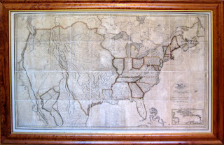
A Highly Important Map of the United States

A highly educated merchant from Scotland, John Melish first visited America on business in 1806. He returned in 1811 to settle in Philadelphia and continue his successful business of commercial cartography where he quickly became one of America’s greatest mapmakers. Until the publication of this grand map of the United States, the growing body of geographical knowledge about America was assimilated primarily on military maps and British commercial maps, none of which had ever encompassed the entirety of U.S. Territory.

With American nationalism strengthening after the War of 1812, a friend mentioned to Melish that he would like to see a map that would condense one grand view of the whole of U.S. Territory. Recognizing the seemingly endless demand for geographical information on the American West, Melish produced his six-sheet map with the help of Philadelphia engravers John Vallance and Henry S. Tanner, which would later be known as his finest achievement. He drew on published eastern state maps and west coast surveys and city studies to create this mammoth sized map which is the first map to show the U.S. Territory stretching from the Atlantic to the Pacific. Little was know about the West, and this map seemed to embody the burgeoning notion of Manifest Destiny.

Although quite beautiful and magnificent to behold, this map functioned as a key in treaties and border disputes between the United States and Mexico in later years. It also improved knowledge of the American West and Texas, and thus promoted settlement in these areas by Anglo-Americans where opportunities for self-advancement and freedom seemed possible.

This map is currently on view at our Jackson Square location at 435 Jackson Street, San Francisco. Please contact us if you have any additional questions about this important map.

Modified Gallery Hours - First week of July

Monday, June 30 - Thursday, July 3rd - 10 a.m. to 5 p.m.
Friday, July 4th - CLOSED
Saturday, July 5th - CLOSED

Monday, July 7th we will resume our regular schedule: Mon - Fri, 10 a.m. - 6 p.m.; Saturday 10 a.m. to 5 p.m.
Happy Fourth of July!

Tuesday, June 17, 2008

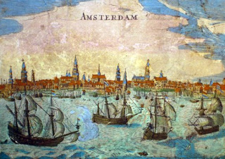
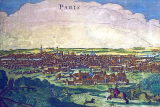
Exquisite Wall Map of Europe by Overton

Detail of vignette of Amsterdam

Detail of vignette of Paris


English cartography rose to prominence at the turn of the 18th century, and one of Britain’s most celebrated cartographers was Henry Overton, who successfully reissued several editions of John Speed's popular county maps of England. One of Overton’s most splendid productions is this wall map, a highly ornamental production that shows Europe as it was in the time of Louis XIV. The map is flanked by sixteen large detailed views of important cities: London, Paris, Rome, Amsterdam, Constantinople, Lisbon, Seville, Antwerp, Venice, Frankfurt, Prague, Cologne, Copenhagen, Kracow, and Danzig. This map is a valuable record of the growth of these cities, presenting an image of them as they were in the 1700’s. The whole is enclosed within a richly colored, highly decorative floral border.
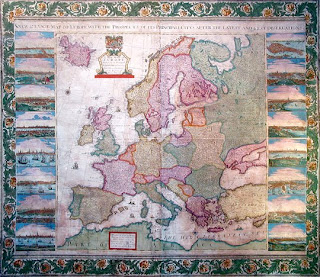

This is a very rare map, not noted by the British Museum Catalogue of Printed Maps. The date of the map is uncertain, but is certainly after 1707, the year in which the mapmaker, Henry Overton, succeeded his father, John Overton. Antique wall maps such as this are exceedingly rare, for lacking the protection of bound maps, they were often destroyed by the effects of light, humidity, and carelessness. Overton’s Europe is a rare example of such a map to survive not only intact, but in excellent condition, with vivid original color.

This spectacular wall map is currently on view at Arader Galleries and available for purchase. For more information, call 415-788-5115.


Tuesday, June 10, 2008

Celestial engravings by Bayer and Cellarius

Andreas Cellarius
Andreas Cellarius
Johann Bayer
Johann Bayer

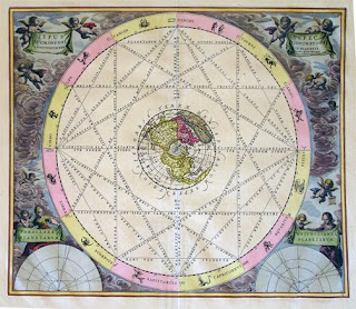
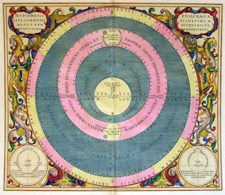
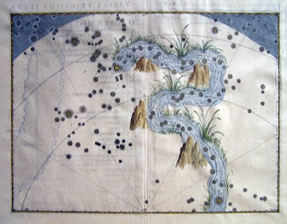
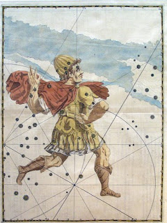
Arader Galleries has a wonderful selection of historically significant Celestial prints. Two prominent artists that we have in our collection are Johann Bayer (1572-1625) and Andreas Cellarius (1595-1665). We are pleased to present original hand-colored copperplate engravings from Johann Bayer’s Uranometria. This first edition was published in Augsburg, Germany in 1603 by Christopher Mangus and only 200 were printed. It contained 51 star charts and was the first atlas to map the entire celestial sphere. The Uranometria charted 12 new constellations in the Southern sky in addition to the existing 48 that were charted by Ptolemy. It was one of the most memorable 17th century guides and was named in honor of Urania, the muse of astronomy. The Uranometria was first atlas to identify astral magnitude (the brightness of stars) with a lettering system. We still use this system today for visible stars. (Greek characters represented brighter stars, Roman characters represented fainter stars).

Bayer was a lawyer by trade and only an amateur astronomer. By publishing his atlas Bayer may have had an ulterior motive; he dedicated the atlas to the city council and prominent citizens of Augsburg who rewarded him with an honorarium and a seat on the city council as legal adviser. This atlas was created about 50 years after the "Peace of Augsburg," a treaty signed between Charles V, the holy roman emperor, and an alliance of Lutheran princes to end the struggle between the two groups. Bayer died near the beginning of the 30 years war in Germany .

Andreas Cellarius, first released the Harmonia Macrocosmica in 1660 in Amsterdam , with a reprint in 1661. A post-humus edition was also produced in 1708 by Schenk and Valk (but without the Latin commentary). In general, the plates of the 1660/61 editions are coloured in bright tones – those of the 1708 reprint tend to be more plain in coloring. There were 29 color plates and the atlas was published by Johannas Janssonius as a cosmographical supplement to his Atlas Novis.
Cellarius was a Dutch-German mathematician and cosmographer born in Neuhausen, Germany. At the time Harmonia was published he was also working as the rector (headmaster) of a Latin school. Cellarius started working on Harmonia shortly before 1647, and originally intended it to be a historical introduction for a two-volume treatise on cosmology but the second part was never published. In addition to their aesthetic appeal the plates represent the most sweeping and ambitious project in the history of celestial cartography. Harmonia illustrates the historical tensions of the times. It was first published in the same year that Freidrich Wilhelm “The Great Elector” gained sovernity over the Prussia, thus ending the Polish fiefdom.

The plates present the evolution of the field of astronomy from ancient times to hypotheses contemporary to Cellarius. They are executed in a distinctive visual language and portrayed the often-conflicting theories that prevailed. In addition to the relatively obscure notions of Tycho Brahe and Schiller, they also track the theories of Ptolemy and Copernicus. During the 17th and 18th century Dutch cartographers such as Cellarius reigned supreme in their field.


Images: Bayer: Cepheus. Eridanus (river) Cellarius: Typus Tuum, Opposi Ptolemaica Planetarum Eccentricos Demonstrans

Wednesday, June 4, 2008

Exquisite Botanical Watercolors by Le Moyne


Jean Jacques Le Moyne is known as the most prominent Huguenot artist in history. Emerging as a court artist in France under Charles IX, Le Moyne was appointed artist and cartographer for the 1562 Huguenot expedition to the New World led by Jean Ribault. While exploring present day Florida and South Carolina with the French Protestant settlers, Le Moyne collected specimens of various flora and fauna which he observed and studied and later turned into beautiful paintings.

His watercolors on vellum were most likely produced from 1568-1572, when he returned from the New World expedition and worked in France before immigrating to England . Though his landscape paintings of the New World were quite popular, his botanicals are considered to be his finest achievement as he was well known in both England and France for his remarkable illustrations. These exquisite watercolors can be seen in our extraordinary paintings annex gallery in San Francisco.

Thursday, May 29, 2008

California as an Island maps


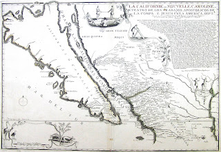
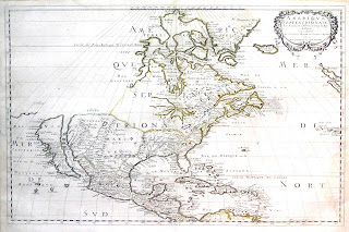
One of the most interesting cartographic myths of the European exploration of the Americas was maps depicting California shown as an island. This famous misconception impacted the accuracy of mapmaking for over a hundred years, until its acceptance of California as part of the mainland was established in the mid-eighteenth century.

Between the years of 1500 and 1747, a lot of confusion ensued over whether or not California, a mysterious land with an abundance of gold, was in fact an island. As early as 1500, California was thought to be an island. As more and more explorers ventured up the coastal region, it was established that California was, in reality, part of the mainland. This discovery, however, did not last long as miscommunications and mistaken observations turned the coast back into an island!

Beginning in the year 1622, California began its cartographic existence as a large island off the coast of Newe Spaine, accompanied by an article by Henry Briggs. The “island of California” appeared to have a rough and rocky coastline complete with smaller islands off the shore. The theory became universally accepted over the next ten years as influential published such as Nicolas Sanson, Fredrick de Wit and Nicolas de Fer created beautiful maps that confirmed California’s insularity. Some maps even highlighted a functional Northern coast with finger-like peninsulas reaching towards the mainland.

Father Eusebio Kino confirmed that California was part of the landmass of America in 1698 by walking to California from the mainland without encountering a body of water, then showing his results in a map published in 1705. Still, it was not until 1747 when Ferdinand VII of Spain declared it part of the mailand, by royal decree stating, “California is not an Island,” that cartographers began to eliminate the myth. Interestingly, the practice of depicting California as an island lasted until 1865 in Japanese cartography.

Arader Galleries is pleased to present to you our collection of these cartographical curiosities, all of which are currently available for purchase at our San Francisco location. Please contact us with any questions you have about this fascinating collection.