skip to main |
skip to sidebar
 View of the interior of the print and works on paper archive room at the British Museum's library.
 Sixteenth century woodworking tools used by Albrecht Durer in his printmaking studio and shop for his original woodcuts. These are housed in the British Museum's print room.
 Laying down paper to pull a print from an inked copperplate. Print workshop director, Michael Mann, from the Slade School of Fine Art in London leads us through the process.
It was an exciting summer for us! Our gallery spent a week in London attending Rare Book School at the University of London. This summer’s course focused on the History of Maps and Mapping which included seminars by top scholars in the field: Peter Barber, Head of British Library Map Collections; Catherine Delano-Smith, Editor of Imago Mundi – The International Journal for the History of Cartography; Laurence Worms, Ash Rare Books; Roger JP Kain, Professor of Geography at University of Exeter; and Sarah Tyacke, President of Imago Mundi and map specialist for Royal Holloway University of London.
During the week, we were able to view select items from the amazing map collection at the British Library. One of the highlights from this collection included an original Martellus manuscript atlas which arrived in England from Italy around 1800 when purchased by George III's son, the Duke of Sussex and then later purchased by the British Museum following the Duke's death in 1844 - truly one of their prized acquisitions.
Another highlight is what Peter Barber claims is one of the most important purchases the British Library has made in recent years - the Mercator Atlas of Europe. A composite atlas containing the only known manuscript maps in Mercator's own hand. Some of the printed maps have annotations in ink in Mercator's handwriting!
To top off this experience, we were also allowed access to the British Museum’s print room. Here, we were able to see some of the items from the permanent collection, including the woodworking tools used by Albrecht Durer to make his woodblocks.
The entire week was an incredible and educational experience! We look forward to next year’s seminars. To learn more about the program we attended, please feel free to contact the School of Advanced Study at the University of London.
We invite you to stop by to see our extraordinary collection of antique prints and original paintings at one of our upcoming shows and gallery exhibitions:
Santa Monica Antiques Show
Friday, September 12 – Sunday, September 14, 2008
http://www.bustamante-shows.com
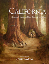
California: Historically Important Maps, Paintings and Views
Exhibition on display from October – December 2008
John Abbot Syndication of Original Ornithological Watercolors
Saturday, October 11, 2008
Arader Galleries New York City Location
Art International Pasadena / Los Angles
Friday, October 31 – Sunday, November 2, 2008
Gala Preview Thursday, October 30, 2008
http://www.artinternationalfair.com/
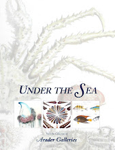
Under the Sea: Fish, Coral, Shells and Other Wonders of the Sea
Exhibition on display November – December 2008
Jackson Square Holiday Walk Event
December – Date to be announced
For more information please call 415.788.5115 or visit www.aradersf.com. Hope to see you at one our events this fall!
 Arader Gallery employees and friend at Tools for School fundraiser:
Nicole Lopez (from left), Jeannie Berkinshaw and Katherine Casey
On August 6th, 2008 at the Omni hotel in San Francisco, Arader Galleries attended a fundraiser held by The Salvation Army, one of the world’s oldest and largest charities. Tools for School, a fundraiser for underprivileged San Francisco school children annually provides about 2,000 students with basic school supplies. The auction collects money for the program to give classroom essentials and proper clothing to students so they begin the school year concentrating on learning.
Arader Galleries donated a print of two French town views by Mathias Merian of for the auction. Please find more information about the Salvation Army and the Tools for School program at http://www1.usw.salvationarmy.org/usw/www_usw_gstate.nsf
 John Melish
Engraved by J.J. Vallance & H.S. Tanner
Published by John Melish Philadelphia
Generally, the cartographer was the mind behind the creation of the maps and atlases and oversaw his productions. He was someone who often came from a family of map-makers or publishers, seemingly falling into the business but undoubtedly having a great passion for his trade. Others realized the demand for geographical information and sought a profession in map-making. Abraham Ortelius, for example, started his career as a map engraver. It was through this profession that he became interested in compiling atlases, and so began his career as a map-maker. Later he would go on to become the geographer to Kind Philip II of Spain. In this task he would travel with the King on his expeditions where he would survey land and use his geographical knowledge to navigate and educate the King on his territories and those of other states.
On the other side of the spectrum, Scotsman John Melish began his career as a publisher. After visiting the United States on business and traveling through the territory extensively, he used his travel accounts to produce maps of early 18th century America. Because he was wealthy, Melish was able to employ the very best engravers for his projects and distribute his maps under his own name. After the publishing of his first set of maps and travel accounts, Melish made his business in Philadelphia in commercial cartography and geography.
Ultimately, the map-maker is known as the author, and his name is the name we remember. But there were many tasks necessary in creating atlases full of beautifully printed, colored and, at the time, accurate maps, and for each of these tasks there were specialists waiting to play their parts in making a map.
 Sixteenth century woodworking tools used by Albrecht Durer in his printmaking studio and shop for his original woodcuts. These are housed in the British Museum's print room.
 Laying down paper to pull a print from an inked copperplate. Print workshop director, Michael Mann, from the Slade School of Fine Art in London leads us through the process.


